
The main street before sunrise.
I lived in the town of Narrabri for approximately seven years. It is located in the north west of New South Wales about 520 kilometres from Sydney on the junction of the Newell Highway and the Kamilaroi Highway. It is situated on the Namoi River, and because of this often floods as rainwater drains from several catchment areas. The population is a little over six thousand people and it is known as 'the sportiest town' according to one television morning show. Certainly when I lived there my neighbours were Olympians, Graham Windeatt and Nira Stove.
Narrabri is also home to many descendants of the Kamilaroi people who originally occupied the area before white settlement. I had a lot to do with the Kamilaroi community and even went to the World Indigenous Youth Conference in Darwin with two Kamilaroi elders and two Aboriginal youths.

Volcanic plug on the way to Mount Kaputar.
The area was once known for beef, lamb and wheat, though all of these have recently taken a back seat to cotton. Of interest in the area is Mount Kaputar, Yarri Lakes and the Pilliga Forest. Mount Kaputar, located in the Mount Kaputar National Park, is 1,508 metres high. It is the remnant of an extinct volcano and it is claimed that on a clear day a seventh of the state of New South Wales can be seen from the mountain's summit. Yarri Lakes are located between Narrabri and Wee Waa, on the edge of the Pilliga Scrub. They are a conical indentation, or three indentations, in the earth, about 3km wide which fill up with water. They are a favourite camping spot, water ski area and a breeding ground for many species of water birds. The Pilliga Forest, better known as the Pilliga Scrub, is the largest continuous woodland west of the Great Dividing Range, and span some 3,000 square kilometres. It is home to over 300 bird species and a number of endangered animals, including the Squirrel Glider, Pilliga Mouse, Rufus Bettong and the Glossy Black cockatoo.

Kangaroo and Joey. Many are found on top of Mount Kaputar.
A tourist attraction at Narrabri is the Australian Telescope Compact Array (ATCA). It consists of six 22 metre antennas while are arranged along a section of railway track. Like the telescope at Parkes they are used for radio astronomy. Located about 25 kilometres from town,the telescope is administered by the Australian Telescope National Facility. The telescope is operated all year around. About a third of the astronomers using the facility come from overseas. Astronomers usually stay at the telescope for about three days. On average two astronomers arrive and leave the facilty every day.

View of one of the antennae at nightfall.
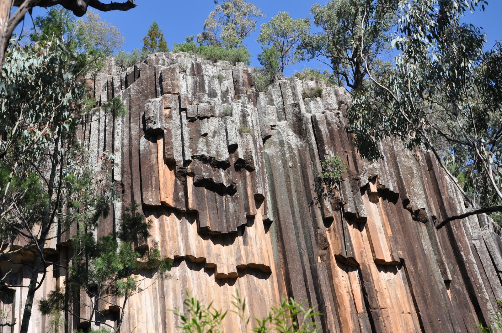
However the main reason I visited Narrabri this time was to photograph the spectacular rock formation known as Sawn Rocks. This is a 40 metre high basalt cliff face made up of octagonal shaped rocks. The whole formation resembles a giant church organ. The rocks are believed to descend another 60 metres into the earth. Some of the rocks have fallen over time and huge fragments lie in Bobiwaa Creek below. These slabs resemble the ruins of Greek temples and give the whole area a 'fairyland' appearance. Below are photos of the basalt wall and of some of the fragments in the creek below.


 On the way back to Sydney I had to pass through the town of Baan Baa. Here is a photograph of the local cricket club. The bus serves as change rooms and grandstand.
 This last photograph was taken on the way up to Narrabri. I travelled at night and passed by the mines near Singleton on the New England Highway while it was still dark.

Love the photos... brings back memories!!!!
ReplyDeleteThere's a trail that leads to the top of Sawn Rocks too, great view!
ReplyDelete